

Experience the Map
Enjoy high-resolution maps from the Edo period that capture the area across different points in time. Much of the layout of the castle town has remained unchanged. By walking around Akō Castle and the castle town while viewing these maps, you can imagine how the area looked in the past.
- TOP
- Experiencing the Past
- Experience the Map
Enjoy high-resolution maps from the Edo period that capture the area across different points in time. Much of the layout of the castle town has remained unchanged. By walking around Akō Castle and the castle town while viewing these maps, you can imagine how the area looked in the past.
Diagram of the Asano Period Akō Castle
Property of Akō High School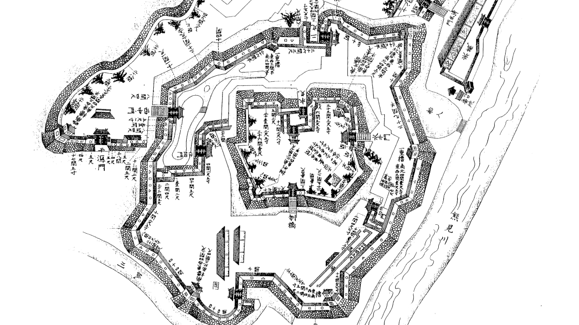
A traced copy of an illustrated diagram depicting the entirety layout of Akō castle. The diagram includes information such as the length of the stone walls and the names of the gates, as well as an illustration of the Ninomaru Gardens.
Expand DiagramDiagram of the Akō Castle Honmaru
Property of Tatsuno Municipal History and Culture Museum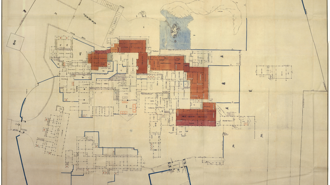
A detailed diagram of the Honmaru prepared under the orders of Ōishi Kuranosuke during the surrender of Akō Castle. The diagram includes even the smallest of details, including the number of doors in the Honmaru. This record bears significance in regard to the construction of the Honmaru.
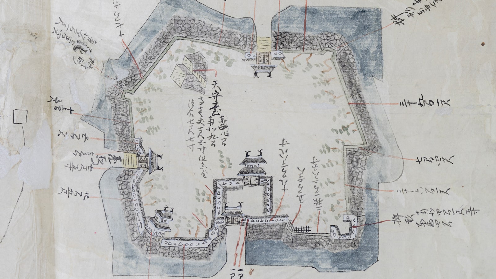
Expand DiagramDiagrams of the Honmaru and Ninomaru
Property of Aoyama Kumiko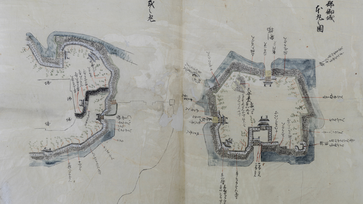
An illustrated diagram depicting the castle walls of Honmaru and the western castle walls of the Ninomaru. The diagram includes details such as the length of the stone walls.
Expand DiagramDiagrams of the Ninomaru and Sannomaru
Property of Aoyama Kumiko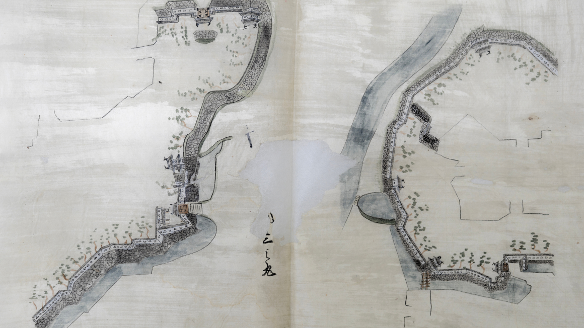
An illustrated diagram depicting the eastern castle walls of the Ninomaru and the western castle walls of the Sannomaru. The diagram includes illustrations of the Ninomaru and Shioya gates.
Expand DiagramDiagram of the Akō Castle Sannomaru
Property of Aoyama Kumiko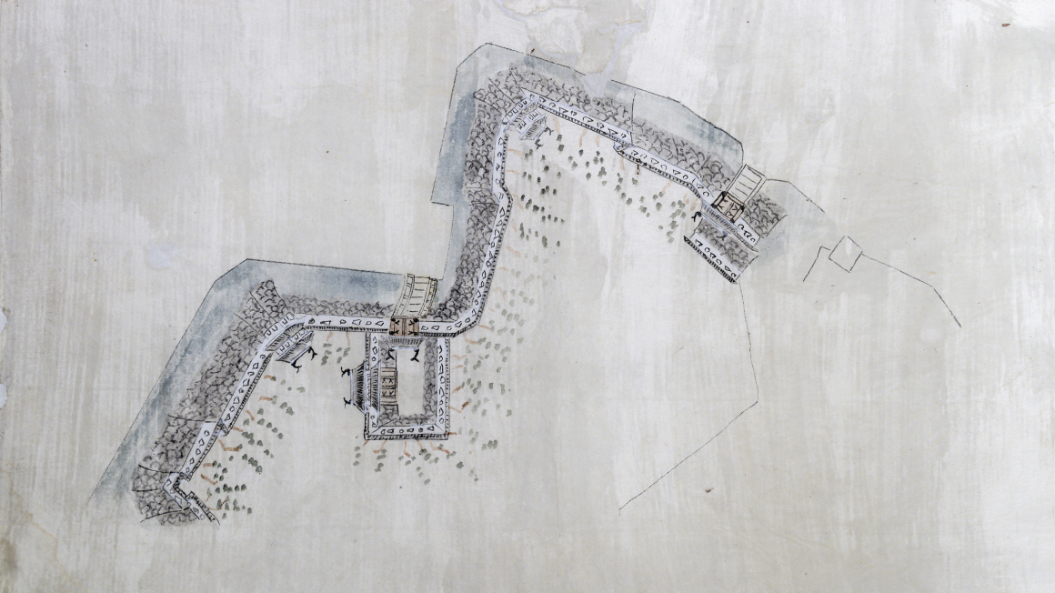
An illustrated diagram depicting the eastern castle walls of the Sannomaru. The diagram includes illustrations of the Ote and Shimizu gates.
Expand DiagramMap of Akō Castle Town under Commissioner Matsudaira Masatsuna's Domain
Property of Akō city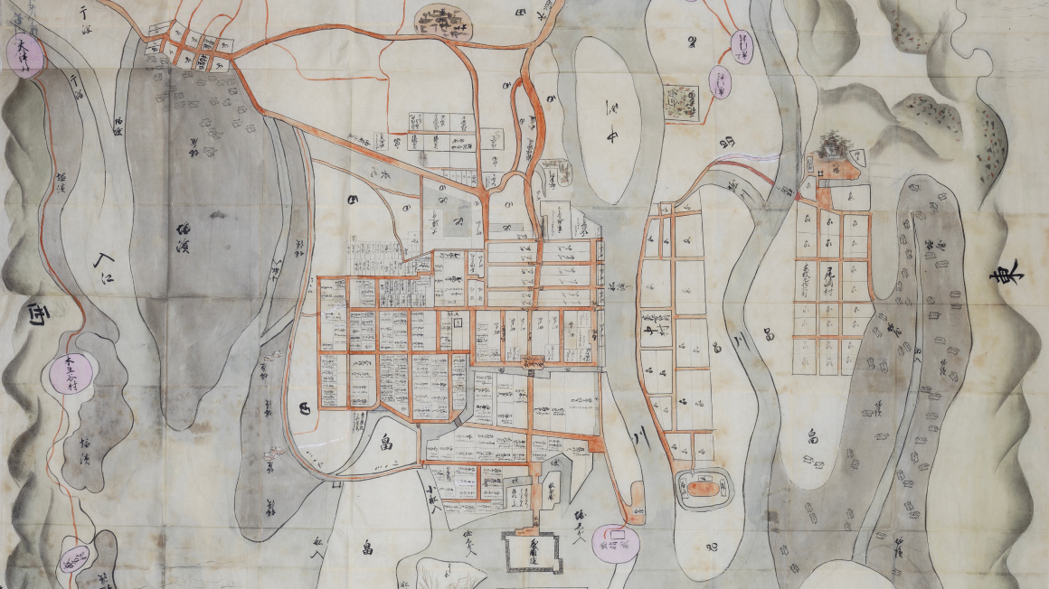
A map illustrating what is believed to be the castle town of Akō during the 1640s. The Akō Castle we know today was yet to be built, and the salt farms utilized the natural terrain.
Expand DiagramMap of the Akō Castle Area
Propety of Himeji Center for Research into Castles and Fortifications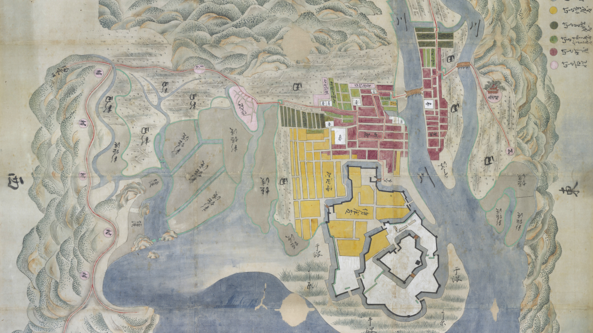
A map depicting the area of Akō Castle when it was first being rebuilt. The fact that the rebuilding of Akō Castle had begun and the lack of the Higashihama Salt Farm's seawall indicates that this map was created between the years 1661 and 1666.
Expand DiagramMap of Municipal Buildings in the Banshū Akō Castle Area
Property of Akō City Museum of History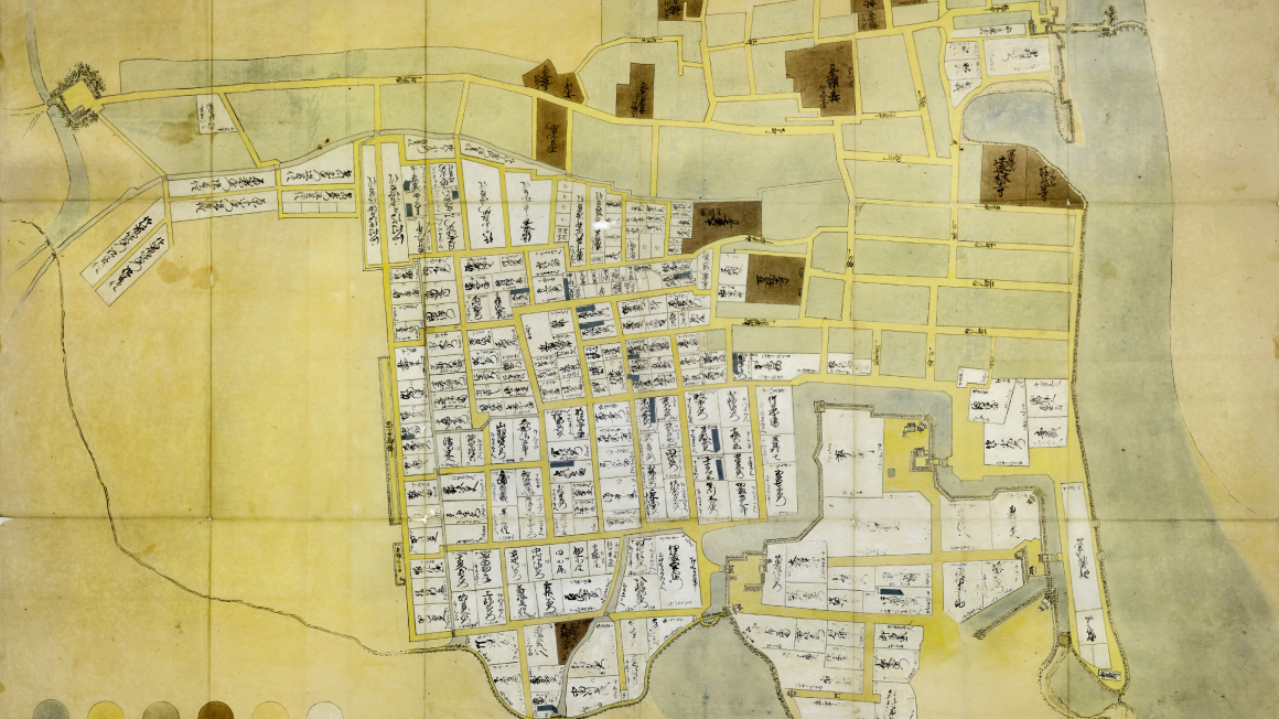
A map of the area during the Genroku period, in which the Akō Incident occurred. The lack of Jonenji temple indicates that this map was likely drawn before 1700. Dark labels were pasted onto the mansions of those who participated in the raid on the Kira residence.
Expand DiagramMap of Asano Period Samurai Residences
Property of Akō city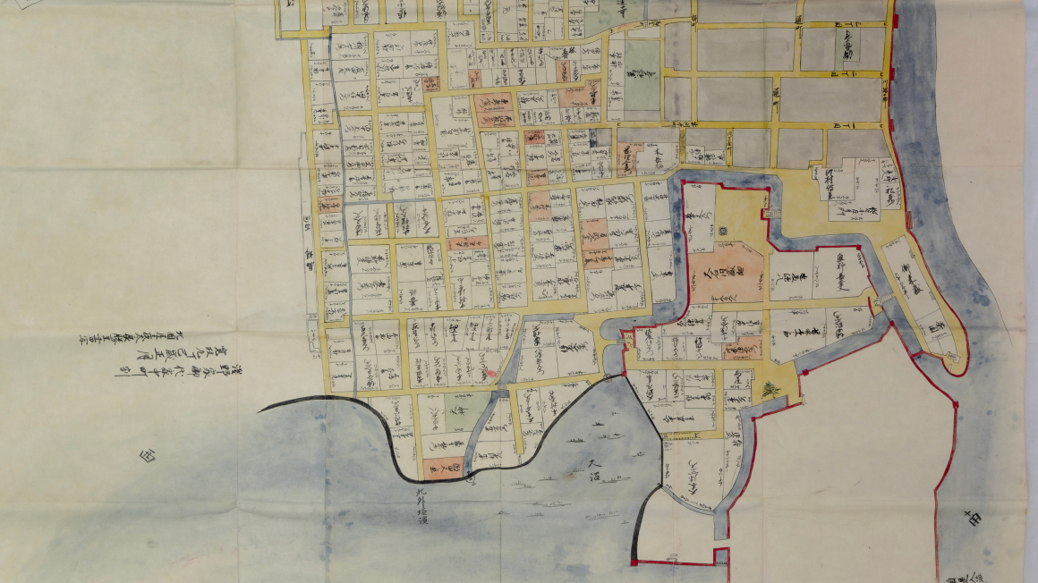
This map is believed to depict the castle town of Akō just after the Akō Incident due to the inclusion of Jonenji temple, which was built in 1701, as well as the names of the Asano family retainers. This is a traced copy created in 1797.
Expand DiagramMap of Akō Castle Town
Property of Akō city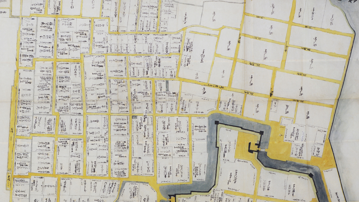
A map depicting the castle town of Akō at the height of its growth, just before the Genroku Akō Incident. The map includes the names of Asano family retainers and the number of rooms in each mansion. Labels indicating official positions and the value of land in terms of bushels of rice were pasted onto the map.
Expand DiagramMap of Samurai Residences in Kamikariya
Property of Akō city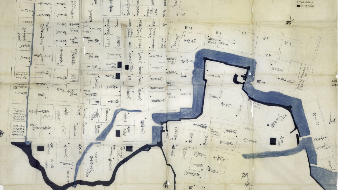
A scaled-down map of the castle town following the punishment of the Asano family in 1701. What stands out on this map are the former residences of low-ranking which are marked for purification, as well as the black squares marking clearly damaged mansions.
Expand DiagramMap of Banshū Akō Castle Town (Residential Map of Asano Period)
Property of Aoyama Kumiko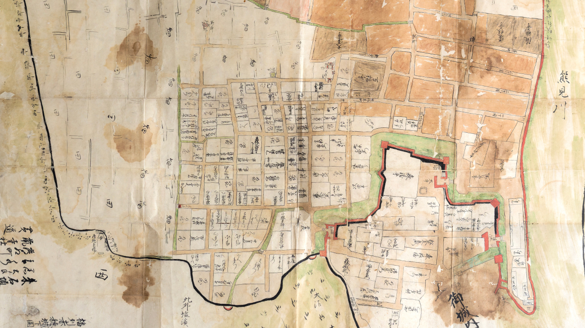
The inclusion of Hakubunkan, a han school established in 1777, and public housing for officials that had burned down in 1778 indicates that this map was created sometime between 1777 and 1778. Following dwindling land values, the number of houses had decreased significantly.
Expand DiagramPalace Floor Plan of the Akō Castle Honmaru
Property of Akō City Museum of History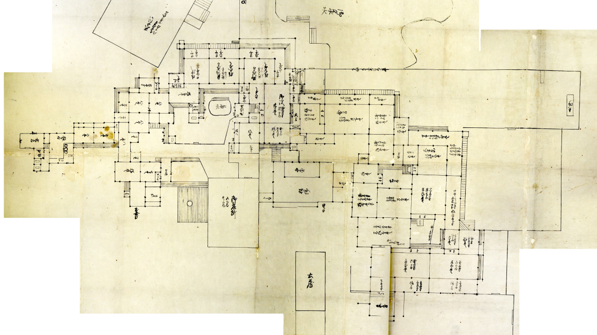
This diagram illustrates the floorplan of the Feudal Lord's palace during the Mori family period, which was renovated in 1861. Compared to the Asano family period, the concubine's private quarters had become smaller. The stairs to the base of the tenshu had also been altered.
Expand DiagramDiagram of Akō Castle Honmaru Waterworks
Property of Akō High School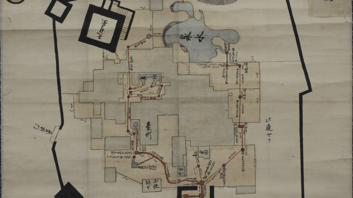
A diagram of the water supply lines within the Honmaru. The configuration of the palace indicates that it was likely illustrated no earlier than 1861. The water supply lines went through the Honmaru gate, past the kitchen, and through the garden pond to fill the garden lake. The water supply line also carried water outside the castle for drainage.
Expand DiagramDiagram of Akō Castle Waterworks
Property of Akō city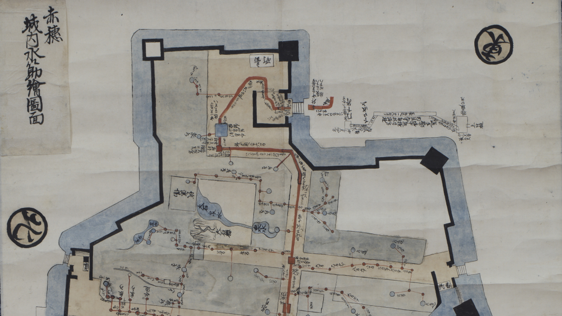
A map of the water supply lines from Akō Castle to the samurai residences. The presence of a paper factory indicates this map was created sometime after 1777. The map illustrates how water had been drawn to each individual residence.
Expand DiagramDiagram of Akō Castle Town Waterworks
Property of Akō city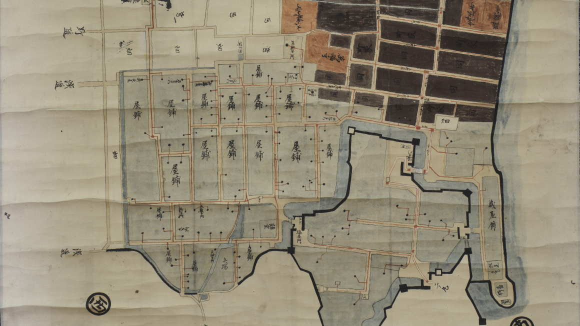
A map of the water supply lines in the castle town of Akō. The presence of Hakubunkan, a han school, indicates this map was created no earlier than 1777. The red lines indicate water supply lines, while the black dots represent wells.
Expand DiagramMap of Makimura and other Bayside Villages in Aioi
Property of Tatsuno Municipal History and Culture Museum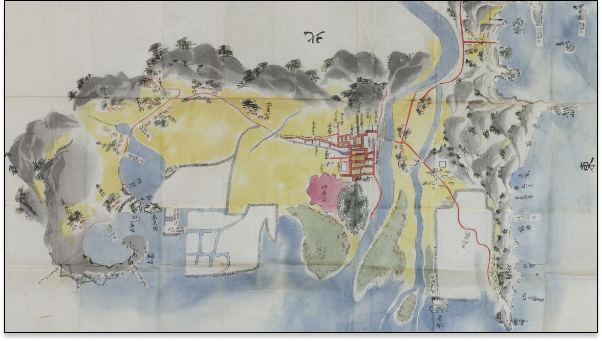
A map of the various villages near the castle town of Akō. The presence of the seawall coast (reclaimed in 1798) indicates this map is from the 19th century. The map shows the development of the sand spits near Tsunasaki.
Expand DiagramMap of New Developments near the Akō Coastline
Property of Akō City Museum of History
This map is a copy of what the Akō domain submitted to shogunate officials inspecting the salt farms developed in 1786. The map provides a detailed record of the development of salt farms.
Expand DiagramMap of the Mori Territory in Akō District
Property of Akō City Museum of History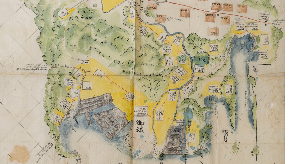
A map that depicts the Mori domain around 1800, as indicated by the development of the salt farms. The map includes notes on an old castle built in the middle ages.
Expand DiagramMap of Akō District
Property of Akō City Museum of History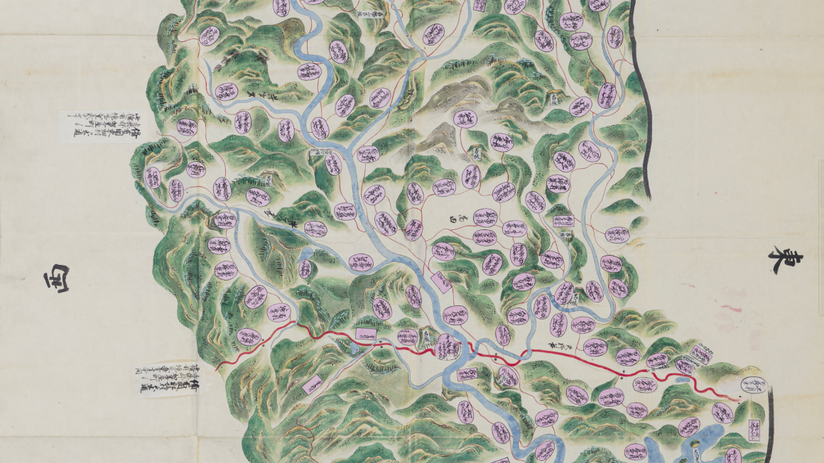
A map depicting the locations of the various villages and major roads in the district of Akō. The map includes the location of an ancient castle from the middle ages.
Expand Diagram
*All rights to the materials posted on this page are subject to copyrights belonging to their respective organizations. Please contact the relevant organizations to request permission to use these materials.
*Some images are composites and may differ from the original materials.